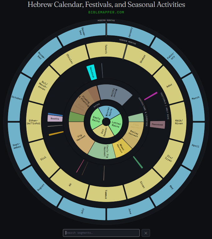
Bible Mapper is pleased to release a clickable, searchable Hebrew calendar that includes festivals and seasonal activities. Click the snapshot below to go to the live calendar. (Note: The calendar must be viewed in a non-mobile browser to work correctly.)
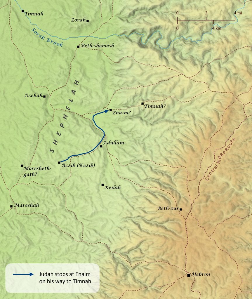
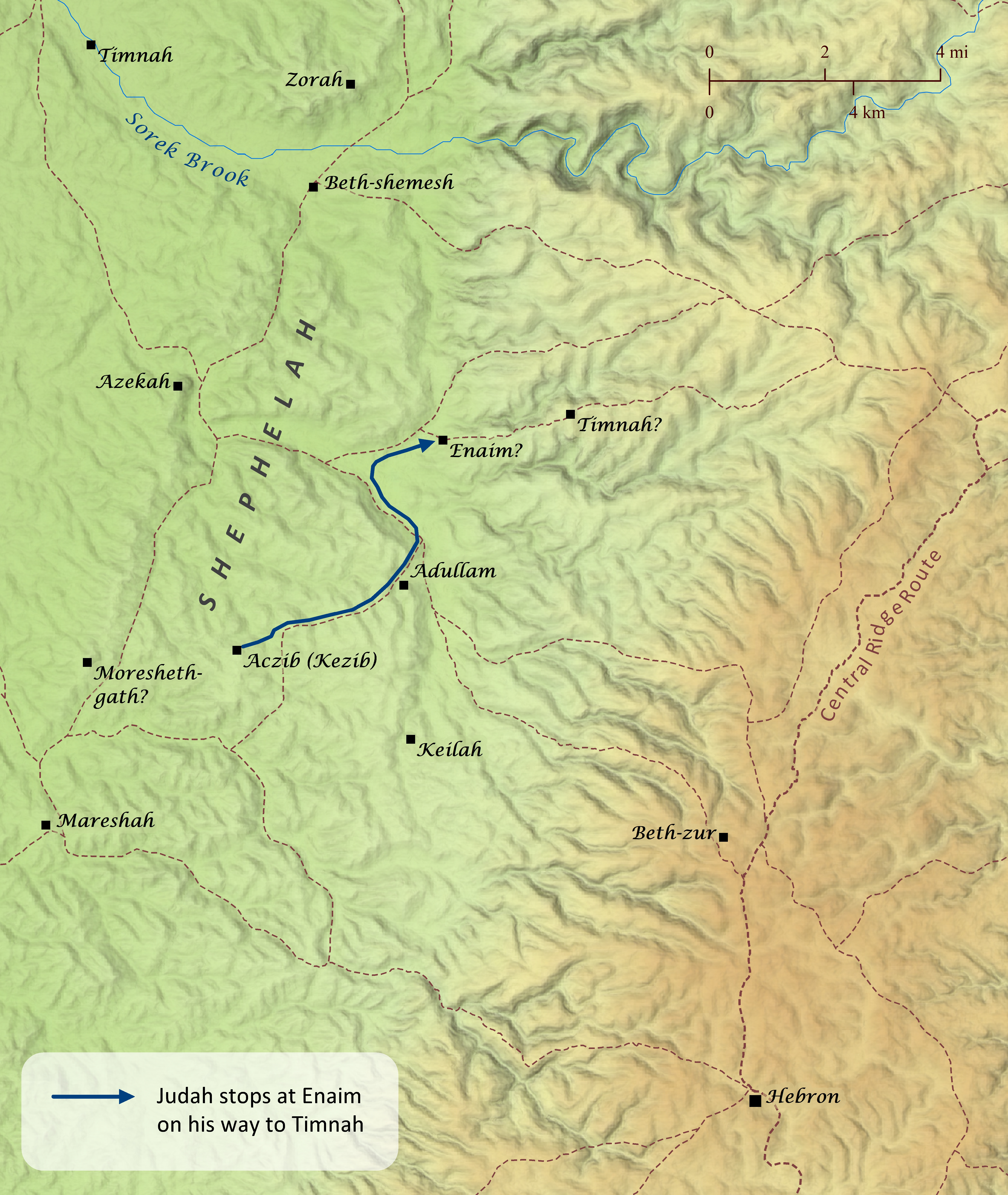
The story of Judah and Tamar is likely set in the foothills (often called the Shephelah) of Judah around the general area of Adullam. The story opens by noting that Judah went “down” from his brothers, though it does not mention where his brothers were living. The last mention of their location, however, is in Genesis 35:27, where it notes that they were in Mamre in the vicinity of Hebron, appropriately situated at significantly higher elevation than Adullam. After settling in this area, Judah married a Canaanite woman, who bore him three sons. The passage also notes that Judah’s wife was living in Kezib when she bore their third son, so presumably Judah was living there as well. This is likely the same location called Aczib elsewhere in Scripture (Josh 15:44; Micah 1:14). Judah then took a wife, Tamar, for his oldest son, but his son soon died. So Judah instructed his second son to fulfill the common custom of marrying his brother’s widow and raising children in his brother’s name. Though this son married Tamar, he refused to have children by her, so the Lord put him to death. Then Judah instructed Tamar to remain in her father’s house as a widow until his third son was old enough to marry her, but secretly he feared that his third son might die like his brothers if he married her. Sometime after this Judah’s wife died, and Judah made plans to go “up” to Timnah, where his sheep were being sheared. Several other passages of Scripture (Joshua 15:10; Joshua 19:43; Judges 14; 2 Chronicles 28:18) mention a place called Timnah, which was located at Tall Batashi along the Sorek Brook, but it is unlikely that this is the same Timnah mentioned in this story, because Tall Batashi is at a very low elevation, so it could hardly be said that Judah went “up” to that Timnah from Aczib or Adullam. Instead the Timnah of Genesis 38 may have been located at Khirbet et Tabbaneh northeast of Adullam (likely also mentioned in Joshua 15:57) and higher in elevation. If Timnah is indeed located there, Enaim may have been located at Khirbet Beth Ikka, though this identification is less certain (see also Joshua 15:34, which mentions a town called Enam). Returning to the story, the passage notes that, upon hearing of Judah’s plans to go up to Timnah, Tamar disguised herself as a prostitute, went up to Enaim, and seduced Judah on his way to Timnah as part of a plan to bring shame upon him for not providing his third son, who was now an adult, to her as a husband. It is interesting to note that the word Enaim, which means “the place of two springs,” can also mean “the place of two eyes,” and some commentators have speculated that the writer was making a play on words with the name of the village, because it was at Enaim that Judah failed to recognize Tamar, and later he failed to recognize his own hypocrisy in denouncing Tamar for her sexual immorality.
At the start of his long and prosperous reign, King Solomon formed an alliance with Egypt and sealed their treaty by marrying Pharaoh’s daughter (1 Kings 3:1). While this ensured no overt military conflict between Israel and Egypt, behind the scenes Egypt was no doubt working to subtly undermine Solomon’s power, as evidenced by at least two occasions when Egypt granted asylum to Solomon’s enemies (1 Kings 11:14-40). After Solomon died, one of those enemies–Jeroboam–returned from Egypt and was made king over the northern tribes, while Solomon’s son Rehoboam continued to rule over Judah (1 Kings 12:16-20). Philistia also appears to have reestablished its independence after Solomon’s death. It must have been clear to Rehoboam that Egypt and Philistia, and perhaps Moab, could no longer be trusted as safe neighbors, because he immediately fortified a number of towns throughout Judah. Interestingly, none of these fortified towns were located between Judah and Israel. Instead, they guarded all routes leading to Jerusalem from the west, south, and southeast. In the fifth year of Rehoboam’s reign, around 926 B.C., King Shishak of Egypt (also called Shoshenq I) launched a military campaign throughout Judah and Israel, attacking numerous towns. Shishak was of Libyan ancestry himself and was aided in his campaign by a vast army of Libyans, Sukkiim, and Cushites. He did not continue to occupy the towns of Israel and Judah, however, suggesting that his primary goal was simply to weaken both nations after the death of Solomon. Shishak recorded his campaign on sculptures in the temple of Karnak near the Egyptian capital of Thebes. Some of the towns noted in his list are difficult to identify with certainty, but those that have been somewhat firmly established are shown on this map. It should also be noted that a large portion of Shishak’s list pertaining to the Judahite towns has been severely damaged, so he likely attacked several other towns not shown on this map. The towns of Jerusalem, Libnah, and Beersheba also must have been among those missing from the Judahite list, because the Bible explicitly notes that Jerusalem was attacked (1 Kings 14:25-26; 2 Chronicles 12:9), and the destruction layers of Libnah and Beersheba suggest that Shishak had destroyed them as well. The Bible also notes that Shishak took away the treasures of the Temple and the king’s palace, including the gold shields that Solomon had made.
Several years after killing his half brother Amnon and his brothers, Absalom was reconciled to his father David (2 Samuel 13-14). Then Absalom spent the next four years grooming the people of Israel to favor him over his father, all in preparation to eventually rebel against his father’s rule. When it appeared to Absalom that the time had finally come to act on his plan, he staged a coup in the town of Hebron about 19 miles (30 km) south of Jerusalem. A messenger came to David and told him that the people of Israel had declared Absalom king, and David chose to flee Jerusalem with his household and many of his officials. They left the city and crossed the Kidron Valley to take the road that went up the Mount of Olives before heading toward Jericho and the Jordan Valley much further east. When he reached the summit of the Mount of Olives, he sent his counselor Hushai back to Jerusalem to act as a false counselor to Absalom and to keep David informed of his plans. Interestingly, 2 Samuel 15:32 notes that the summit of the Mount of Olives was “where God was worshiped.” Sometime during the ministry of Samuel, the Philistines defeated the Israelites in battle at Ebenezer near Aphek and captured the Ark of the Covenant. They took it to Ashdod, Gath, and Ekron but eventually returned it to Israel, where the Ark was then taken to Kiriath-jearim (1 Samuel 4-5; also see “The Ark of the Covenant Is Captured and Returned” map). After the battle, the worship center of Shiloh appears to have been overrun as well (Psalm 78:60; Jeremiah 7:12-14; 26:6). Many of the priests apparently relocated to the town of Nob near Jerusalem, perhaps on the summit of the Mount of Olives (1 Samuel 22:11; Isaiah 10:32; see “The Ark of the Covenant in the Promised Land” map), while the Tabernacle and altar were relocated to the High Place at Gibeon/Gibeah (1 Chronicles 16:39-40; 21:29; see “David Transports the Ark of the Covenant to Jerusalem” map). A little beyond the summit of the Mount of Olives, Ziba, the servant of Saul’s grandson Mephibosheth, met David with donkeys and food for his journey. When David learned that Mephibosheth was making plans to regain the kingdom of his grandfather, David rewarded Ziba’s loyalty by granting him all of Mephibosheth’s inheritance. As David and his officials passed by Bahurim, one of Saul’s relatives came out and cursed David and threw stones at him and those with him. David chose not to stop him and continued on to the Jordan River (see also “Absalom Rebels against David” map).