
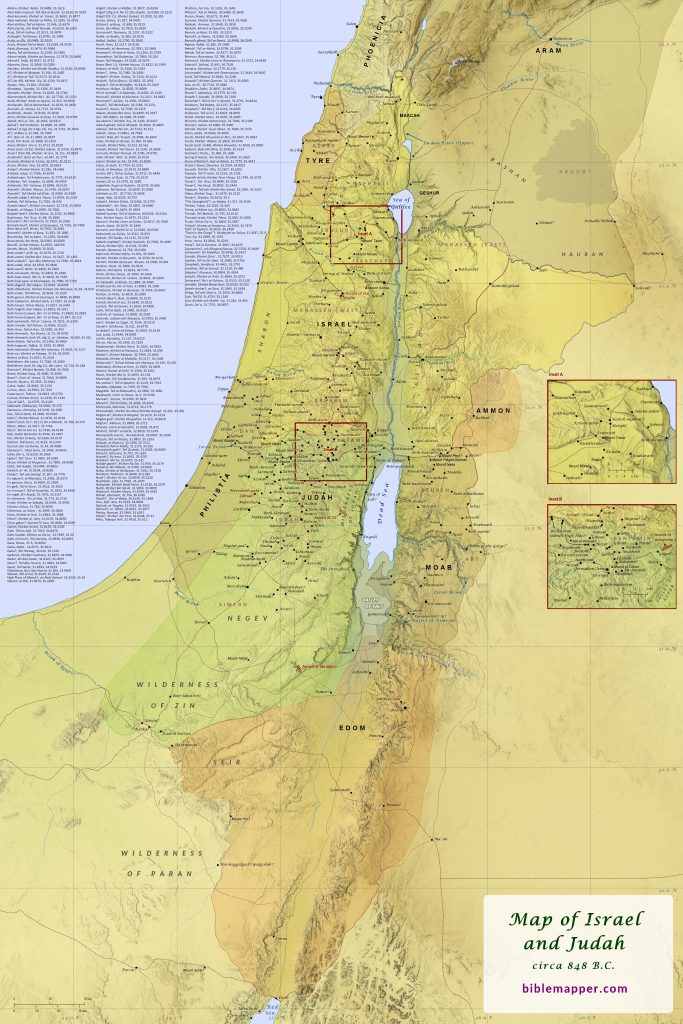
Soon after King Solomon of Israel died, the nation of Israel divided into the northern kingdom of Israel and the southern kingdom of Judah (1 Kings 12; 2 Chronicles 10; also see map). Initially Moab remained subject to Israel, and Edom remained subject to Judah, but by 848 B.C.–the approximate era displayed on this map–both nations had revolted and reasserted their independence, as did the city of Libnah (2 Kings 1:1; 8:20-22; 2 Chronicles 21:8-10; also see map). By this time Moab had also expanded its domain northward, seizing the territory allotted to the tribe of Reuben. This area had formerly been under Moab’s control until the Amorite king Sihon captured the region sometime before Israel crossed the Arnon River on their way to the Promised Land (Numbers 21:26; also see map). The borders between all of the nations included in this map shifted from time to time, but generally they remained as shown here until the northern kingdom of Israel fell to the Assyrians in the final decades of the eighth century B.C.
This map is designed to be printed at 24 in. x 36 in., but it may scale acceptably at larger or smaller sizes as well.
Order as a pre-printed, matte poster (2 ft x 3 ft). Price: $24.90, plus shipping ($9.49) and tax.